|
Munnar was a summer resort of British
Government in South India at a round
5400 ft above sea level. It is pronounced "Moon-aar" meaning
"Three rivers" in Tamil and Malayalam. There are in fact three
rivers - Madupetti, Nallathanni and Periavaru which flow through
this town, but join some distance away from Munnar. round
5400 ft above sea level. It is pronounced "Moon-aar" meaning
"Three rivers" in Tamil and Malayalam. There are in fact three
rivers - Madupetti, Nallathanni and Periavaru which flow through
this town, but join some distance away from Munnar.
The organic landscape, and all its
overwhelming colossuses, has been left untouched with the
magnificent stretch of wilderness of tall trees where cardamom
covered tufts of land beckons one into an aromatic and dreamy
landscape. Beautiful landscape, cool climate and wonderfully
scented tea leaves are some of the other aspects that make this
place a much sought after tourist destination. One can almost feel
the divine vibrations of the past history echoing alive in every
tree. And in the silence, hear one's own thoughts taking shape. In
this virginal remoteness, even time moves at a different pace.
Places to See
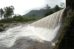
Mattupetty Dam:
Mattupetty is situated at a height of 1700m above sea level, 14 km
from Munnar. Mattupetty Lake and Dam is a beautiful picnic spot w ith
the panoramic view of the tea plantations and the lake. Boating
facilities especially speed boat ride through the dam is
available. Mattupetty is also well known for its highly
specialized dairy farm - Indo-Swiss Live Stock project. The Shola
forests in and around Mattupetty are ideal for trekking and are
habitat to a variety of birds. Rivulets and cascades crisscross
the terrain here, which again adds more attraction to the place. ith
the panoramic view of the tea plantations and the lake. Boating
facilities especially speed boat ride through the dam is
available. Mattupetty is also well known for its highly
specialized dairy farm - Indo-Swiss Live Stock project. The Shola
forests in and around Mattupetty are ideal for trekking and are
habitat to a variety of birds. Rivulets and cascades crisscross
the terrain here, which again adds more attraction to the place.
Eravikulam National Park
Situated 13 Km away from Munnar, a sanctuary for the
endangered mountain goat of South India, the Nilgiri Tahr (
Hemitragus hylocrious), the Eravikulam National Park stands out
for the stark beauty of its rolling grasslands and shola, spread
over 97 sq km in the Rajamalai hills.
Nyayamakad
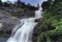
Located between Munnar and Rajamalai, Nyayamakad is a land of
breathtaking waterfalls. The waters cascade down a hill from a
height of about 1600 meters. The enchanting surroundings make an
excellent picnic spot and trekking point.
Kundala Dum
Kundala is a picturesque town on the way to Top Station at a
distance of 23 km from Munnar. The Golf Course which belongs to
Tata Tea Ltd. is located here. The Kundala artificial arch dam is
another attraction. Aruvikkad Waterfall is also near Kundala.
Devikulam
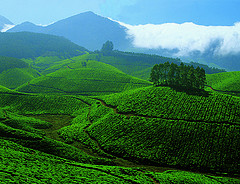
Located 7 Km away, tourists are attracted to this lake town which
has hills after hills covered with tea plantations.
Echo Point Has a natural echo phenomenon and offers
panoramic views along the road to Top Station.
Power House Waterfalls
(18 km from Munnar) - The waterfall on the way to Thekkady from
Munnar cascades down a steep rock 2000 mtrs above sea level. The
spot is enriched with the scenic Western mountain ranges, and is
an ideal place for a break on the way to the Periyar Wildlife
Sanctuary in Thekkady.
Anayirangal
(22 kms from Munnar) - It's a lush green carpet of tea plants. A
trip on the splendid reservoir is an unforgettable experience. The
Anayirankal dam is surrounded by Tata Tea plantations and
evergreen forests. It is an ideal picnic spot.
Tourist Circuits in Munnar
1. Mattupetty Dam - Indo Swiss Livestock Project - Echo Point -
Kundala Dam - Top Station (34 km).
2. Munnar - Pothamedu - Chitrapuram - Pallivasal - Cheyappara -
Adimali - Valara (40 km).
3. Munnar - Rajamalai - Marayoor - Chinnar (70 km).
4. Munnar - Devikulam - Lock Heart Gap - Power House Waterfalls -
Anayirankal (32 km). |